Showing posts with label 2016 Is Strange. Show all posts

Tuesday, January 3, 2017

2016 is strange - Part 29

This is (I believe) the last video from Youtube's Last Messages for the year 2016.


The skies are especially weird in this one!

2016 is strange.

Tuesday, December 6, 2016

2016 is Strange - Part 28

Latest video from Last Messages.


Lots of weird things going on... weird clouds, weird weather, weird events in the ground, in the sky...

Enjoy!

Saturday, October 8, 2016

Saturday, September 24, 2016

Almost like an Semicolon!

Here is a short vid of two clouds I took from inside the local Public Library, New Orleans, La.


2016 is strange!

Friday, September 16, 2016

2016 Arctic Ice Extent Second Lowest on Record.

This image from Zack Labe at Twitter:

Source: Zack Labe
It looks like, according to the JAXA plot, that the 2016 Arctic Ice Extent minimum beats 2007's by just a hair. But they have other information indicating the 2016 low is third lowest.

2016 is strange!

Wednesday, September 14, 2016

Hottest August On Record!

It appears to have tied for first place with July 2016 as the hottest month on record *ever*.

Here's the pic:

Source: ThinkProgress-Climate.
From ThinkProgress-Climate:
We appear to be in the midst of the long-awaited jump in global temperatures. 
And that means “The kinds of extreme weather we have seen over the past year or so will be routine all too soon, but then even worse records will be set,” as Kevin Trenberth, one of the world’s leading climatologists, told me. 
NASA has reported that last month was not merely “the warmest August in 136 years of modern record-keeping,” it tied with this July 2016 for the “warmest month ever recorded.” And for 11 straight months (starting October 2015), the world has set a new monthly record for high temperature. 
So even though 2014 set the record at the time for the hottest year — and then 2015 crushed that record, NASA says there is a greater than 99 percent chance 2016 will top 2015. And it probably won’t be close ...
More here.

2016 is strange!

A New First! A Tropical Cyclone Forms over Land.

Yesterday PBEarthWatch posted this video on YouTube:


This was only a tropical disturbance yesterday afternoon. BPEarthWatch predicted a rapid storm development despite it being over land. And it did develop, as Tropical Storm Julia, first I've heard of to develop over land; -- well it's the Florida East Coast at mid-peninsula, but still --, you'd think this was something that happened every so often in the past but I've no recollection of any such development.

Well today it's over Georgia! It's expected to weaken into a Tropical Depression and go further inland, perhaps to Augusta, GA, though I don't expect it to.

Source: National Hurricane Center via Brevard Times.
I expect the storm to eventually veer east and head out to sea, but these storm models have their predicted storm-tracks all over the map:

Source: South Florida Water Management District via Brevard Times.
Well it turns out Julia HAS veered east; here is her position as of 11AM EDT this morning:

Source: National Hurricane Center.
And here's the latest on the hurricane models. Still all over the map! Two have Julia going up the coast and out to sea, two have her going out to sea and then recurving back WEST, and two have her moving inland!

Source: Weather Underground.
Dr Jeff Masters hasn't commented on this storm yet as of 10:47 CDT this morning, but I expect him to say something later on today. Meanwhile, what he said about the disturbance last night can be read on this webpage here (scroll down about 1/4 of the page).

In other news, a Category 5 Super Typhoon is bearing down on Taiwan (the main subject of Jeff Master's article).

Well I did a looking into on the matter if a named Tropical Cyclone or equivalent has ever formed over land before, and guess what... this is the very first time in the record books that such a storm has *ever* formed over land.

2016 is strange!


Sunday, September 11, 2016

Sunrise September 11 2016

Another one of my videos under a different moniker, Pfctvs Pontivs Pilatvs at YouTube.


2016 is strange!

Tuesday, August 30, 2016

Sunset and Sunrise

Some photos from Sunset the day before yesterday and sunrise yesterday morning.

Sunset, August 28, 2016, 7:39 PM.

Left.

Centre.

Right.
The setting sun has created an effect in the clouds that make them appear to be self-illuminating.

Sunrise, August 29, 2016, 6:44 AM.

Left.

Centre.

Right and at an angle to catch the overhead.
The sunlight is leaking through the breaks in the clouds, even if the Sun hasn't peeked above the horizon yet, and the red sunbeams are hitting the overhead clouds giving a wicked awesome effect to the uneven side of the overcast.

2016 is strange!

Monday, August 29, 2016

Invest 99-L, the Little Tropical Disturbance That Could.

All last week hurricane watchers from Dr. Jeff masters at Weather Underground to Florida and Gulf Coast meterologists to self-taught amateurs to even conspiracy theorists were all watching this disturbance. At least one or twice this tropical wave died out and resurrected itself. But it has managed to get into the Gulf of Mexico and the NHC has now renamed it Tropical Depressiion Nine.

Here are some maps to show the current status and possible future paths.

GOES Satellite Image. Source: NFSC NOAA
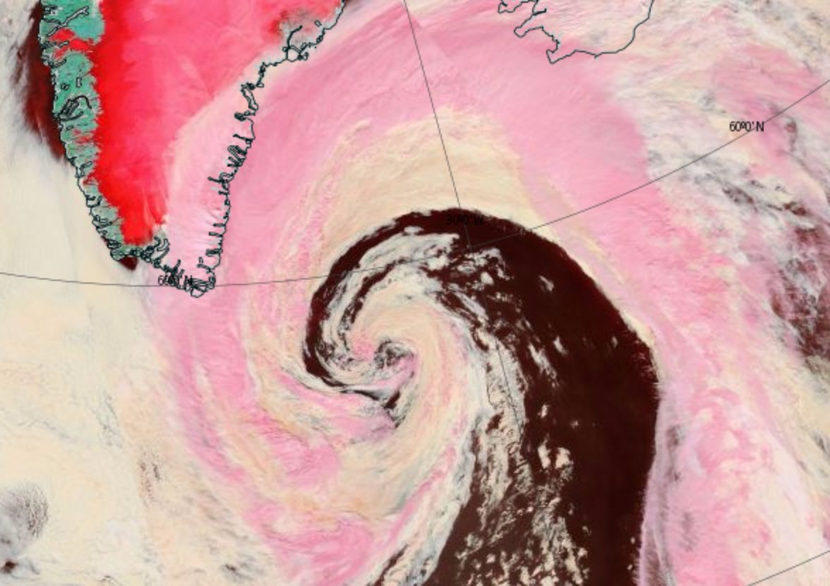
Above, the latest photo taken today, August 29th, 2016 at 1700 UTC (Greenwich Mean Time) or 12:00 PM Central Daylight Time, shows TD9 blooming up as it pushes off the northwest coast of Cuba. The Gulf is quite warm, so it looks like the tropical low will strengthen quite a bit, although the National Hurricane Center predicts it will only become a tropical storm -- to be Christened Hermine or Ian.

Forecast location and intensity by simulated IR brightness temp. for August 29th, 2016 at 09z (UTC = 4 AM CDT)
Source: TropicalTidbits.com
In the HRRR forecast simulation above, tomorrow at about 4AM CDT TD9 will become a tropical storm situate in the middle of the Gulf right south of Pensacola, Florida. A wicked outer band will be crossing Collier County and central and southern Miami Dade County, Florida at that time.

Forecast location and intensity by composite reflectivity (dBZ) and mean sea level pressure (mb) for August 29th, 2016 at 09z (UTC = 4 AM CDT).  N. B.: dBZ = decibels and mb = millibars. Source: TropicalTidbits.com
In the above HRRR rainfall intensity forecast map for the same time tomorrow as the previous one, the tropical storm will have a central pressure of 998 millibars -- just under the strength required for a Category 1 Hurricane.

MSLP model forecast for North America on Friday, September 1 2016 0:00 UTC (GMT = 7 PM August 31st CDT).
Source: Centre Meteo UQAM Montreal
The above forecast map for September 2nd by Centre Meteo UQAM Montreal predicts the tropical storm will be about to go ashore in the Mobile, Alabama / Pensacola, Florida area. Central pressure of the storm going ashore is 964 millibars, which means it should be a minimal Category 1 Hurricane.

Seven-day forecast map starting August 29, 2016 at 0:00 UTC (7 PM CDT August 28). Source: ECMWF.IFS
This above map forecast for September 5th, 0:00 UTC (& PM CDT September 4th) shows the present TD9 as a sprawling extratropical / posttropical storm out in the Atlantic south of Newfoundland. But what's this other storm to the south of it? That looks like a developing West Indies Cyclone bearing down on the Atlantic just north of the Antilles. It may be a Category 3 or higher hurricane at this time, so if you live in South Florida or anywhere on the Gulf Coast, including Mexico and the Florida Peninsula, look out! This storm may have a major city's name on it.


Friday, August 26, 2016

Tropical Disturbance 99-L

This thing is out in the Carribbean now but it has South Florida over open sights and its further destination is anywhere between Apalachicola FL to the Texas Gulf Coast.

Source: Weather Underground.
Southern Louisiana in the Baton Rouge area is a mess right now from the epic thousand-year floods just a couple of weekends ago.  Some rivers are still above flood stage, which means a tropical storm or a hurricane could really F things up over there. Here in New Orleans the ground is completely sogged. We had a tropical monsoon just like they have in South Florida yesterday afternoon and some of the flood puddles have yet to completely disappear, which means we might get some bad flooding, too, especially where the water backs up from street drains or if the pump houses lose their power. The NWS is predicting four to eight inches of rain from this thing both in South Florida and along the Gulf Coast. It may be worse! After all, that 30 inches of rain in Baton Rouge wasn't exactly predicted (yeah, the NWS predicted wicked heavy rains up to two feet appropriate to a five-hundred-year storm but the deluge exceeded that even).

For more information click here , here and here.

Tuesday, August 16, 2016

Meanwhile, up in Greenland and in the Arctic Ocean...

Tips o' th' hat to dtlange and Robertscribbler. And now Cate.

Yesterday north Atlantic low-pressure system acquired at least one hurricane characteristic -- a well-defined eye!

Source: PBS.org.
The system has moved closer to Greenland and appears, judging by the windspeed map on the Earth Nullschool website, to have retained its eye. This cyclone could move up to the north of Svalbard and intensify to 955 mb, but the chances are slight.

 August 18th UPDATE -- Wicked swells off of Newfoundland: "This low off Greenland was producing incredible seas along the NE coast of Newfoundland on Monday and Tuesday—huge swells rolling in and crashing furiously over the top of 300-foot cliffs, in weather that was warm (mid-20sC) and windless, with cloudless blue skies. An astounding sight."- From Cate at Robertscribbler.

Image source: Tropical Tidbits.
CMC 10-day forecast model run showing an extremely powerful 955-mb low just north of Svalbard on August 25th. Such a storm is low-probability at this time, but its formation would likely result in serious impacts to sea ice. (Robertscribbler)
Meanwhile there's another cyclone that came out of Siberia via the Laptev Sea, and is coming up right up by the North Pole, stronger than the one off of Greenland.

"Great Arctic Cyclone" of 2016 as of yesterday, August 15th.
Image source: LANCE MODIS.
Also yesterday. Image source: Earth Nullschool.

Storms, heat and moisture feed up through a high-amplitude wave in the Jet Stream over northern Europe and Siberia and into a developing Arctic cyclone over the Laptev Sea during the early hours of August 15, 2016.
 
Central pressures in the storm fell to 969 millibars and the winds whipping out over the Laptev, East Siberian, and central Arctic waters gusted at 45 to 55 miles per hour. Waves of 6 to 10 feet or higher roared through the newly-opened waters filled with increasingly dispersed ice floes.  (Robertscribbler)

Since then the storm's strongest winds have calmed down to about 42 kmph, which is just north of 25 mph.

There was another such storm in 2012, which helped the sea ice area and extent reach record lows that year. This storm won't even come close to doing that, but it could cause the Arctic Sea ice to meet or fall below the levels set in 2007 and 2015.

2016 is strange!


Meanwhile, up in Greenland and in the Arctic Ocean...

Tips o' th' hat to dtlange and Robertscribbler.

Yesterday north Atlantic low-pressure system acquired at least one hurricane characteristic -- a well-defined eye!

Source: PBS.org.
The system has moved closer to Greenland and appears, judging by the windspeed map on the Earth Nullschool website, to have retained its eye. This cyclone could move up to the north of Svalbard and intensify to 955 mb, but the chances are slight.

Image source: Tropical Tidbits.
CMC 10-day forecast model run showing an extremely powerful 955-mb low just north of Svalbard on August 25th. Such a storm is low-probability at this time, but its formation would likely result in serious impacts to sea ice. (Robertscribbler)
Meanwhile there's another cyclone that came out of Siberia via the Laptev Sea, and is coming up right up by the North Pole, stronger than the one off of Greenland.

"Great Arctic Cyclone" of 2016 as of yesterday, August 15th.
Image source: LANCE MODIS.
Also yesterday. Image source: Earth Nullschool.

Storms, heat and moisture feed up through a high-amplitude wave in the Jet Stream over northern Europe and Siberia and into a developing Arctic cyclone over the Laptev Sea during the early hours of August 15, 2016.
 
Central pressures in the storm fell to 969 millibars and the winds whipping out over the Laptev, East Siberian, and central Arctic waters gusted at 45 to 55 miles per hour. Waves of 6 to 10 feet or higher roared through the newly-opened waters filled with increasingly dispersed ice floes.  (Robertscribbler)

Since then the storm's strongest winds have calmed down to about 42 kmph, which is just north of 25 mph.

There was another such storm in 2012, which helped the sea ice area and extent reach record lows that year. This storm won't even come close to doing that, but it could cause the Arctic Sea ice to meet or fall below the levels set in 2007 and 2015.

2016 is strange!

Sunday, August 14, 2016

Second Wicked Bad Flooding in SE Louisiana This Year.

Source: NBC News

The absolutely MASSIVE floods from the torrential rains that fell here in Southeast Louisiana were so bad, they are now considered unprecedented and historic, an event once every thousand years event. By the aerial photos I looked at, the floods appear to be record-breaking. Baton Rouge, Tangapahoa Parish, West St Tammany Parish and areas contiguous thereto appear to be especially hard hit. Major Routes I-12, Rte. 190 and Rte.22 were shut down, closed to all traffic.

UPDATE: It turns out that parts of Rte. I-55 and Rte. I-10 were also shut down by the massive, massive floods. Some of these roads still are shut down as the floodwaters now are gradually receding.

Rouses Supermarket in Denham Springs is invaded by SIX FEET of floodwater.
Only the top roofs of the SUVs are showing. Source: Rouses via Nola.com.
Here's a slideshow video of yesterday's floods.


Here's another video posted by Men of Valor, i.e., superstitious Christians, also on YouTube. Please ignore the commentary when it veers off into opinion. And don't troll them!


And we had similar flash floods from 26 inches of rain earlier this year, in March. I don't remember the I-12 Expressway being closed during that disaster. They were also a once in a thousand years event.

Two thousand years' floods in one year, only four and a half months apart. Some of the same places appear to have been flooded twice!

At least Jefferson and Orleans Parishes escaped both  events.

2016 is strange!

Friday, August 12, 2016

Some Photos from the Evening of August 6th.

Taken at 7:38 PM.
In this photo, the Sun appears to be trying to peek between the two banks of cumulonimbus (thunderstorm) clouds. But the cloudbanks overlap each other and the high cirrus clouds at the top of the other clouds is catching all the white light.

Taken at 7:54 PM
This was taken at five minutes past Sunset. The effect of the Sun trying to peek between the clouds has grown a lot fainter. The high cirrus clouds have appeared to have grown, but the cumulonimbus clouds from the right have occluded them.

Taken at 7:55 PM
One minute later. The cumulonimbus clouds have grown just a bit.

Saturday, August 6, 2016

It's only August 6th and Already...

You Tube's Last Messages has a new vid out.

 2016 IS STRANGE Part 24 // JULY-AUGUST

2016 is strange!

Monday, August 1, 2016

2016 IS STRANGE Part 23 // JULY

LAST MESSAGES' latest: Part 23 for the end of July. It starts off with the Ellicitt City, MD flood. The inundation was at the 1,000 year estimated flood level. In a normal world this shouldn't happen for another thousand years. But in the present climate it could happen next month!


What follows (but not immediately) is indicated by the teaser photo -- a stunning display of clouds at sunset in South Florida with "multiple suns" in the clouds.

2016 is strange.