They had one just last month and this time they just had another! It was a 500-years' storm according to the people who track the frequency of storms. Flooding wicked bad in the Brazos valley - a 53.5 foot floodwater crest (I hope it's not the DEPTH of the expected floodwater at its crest!). Instead of 7 or 10 inches of rain, they've been getting 16, 19, even 30 inches of rain in one day... causing immense flash floods in minutes! Then the regular floods follow.
As Robertscribbler reports:
 |
| (Image source: NOAA.) |
All time record rainfall totals that might be associated with a powerful hurricane. Floods that would typically happen only once every 500 years. But in the new moisture-laden atmosphere of a record warm world, a garden variety thunderstorm now has enough atmospheric oomph to frequently set off what were once multi-century floods.
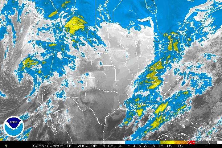
 |
| From Lehmann via Peter Sinclair via Greg at Robertscribbler. |
Rain bombs again explode over Texas in a huge complex of storms on Tuesday afternoon in this GOES enhanced satellite shot. It’s all part of the same stormy weather pattern — associated with a trough and an upper level low — that over the past five days produced another round of record flooding over Texas. And it’s expected to remain in place through the end of this week. With more severe storms firing and 4-8 inches of additional rainfall on the way for some sections of soggy Texas, it appears that still more extreme flooding is likely.
It’s under these new, freakish, conditions that the Brazos River is today expected to crest at 53.5 feet — its highest level ever recorded. And this crest is predicted to push a flood of 8-9 feet into neighboring communities. Extreme flooding that local officials say Texans are not at all prepared for. In total, more than 40,000 people have been urged to evacuate. But with the worst flooding still on the way, the situation is still very fluid.
In isolation, the current Texas floods would be an extreme record disaster worthy of the weather history books. But it is just one of three such severe rainfall events to strike southeastern Texas since April. And, unfortunately, more storms are on the way as a strong ridge of high pressure out west is expected to generate another deep Central US trough and related rain bomb inducing storm pattern over the next five days.
Robertscribbler: New Extreme Climate to Hurl More Rain Bombs at Texas.
Another rain bomb by June 6th. 500-year storm again in the same place, perhaps? That'll be something!
Another rain bomb by June 6th. 500-year storm again in the same place, perhaps? That'll be something!
And they usually spend themselves out by the time they reach here in New Orleans... although this Memorial Day we did have heavy, windy rainstorm that looked like a hurricane at times, with wind coming from the East at one time and then the West later on and then back again! Should have taken a video.
But one of these days our luck will run out.
Hell's bells. Oh, Sugar.
No comments:
Post a Comment